


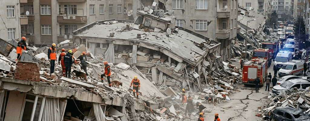

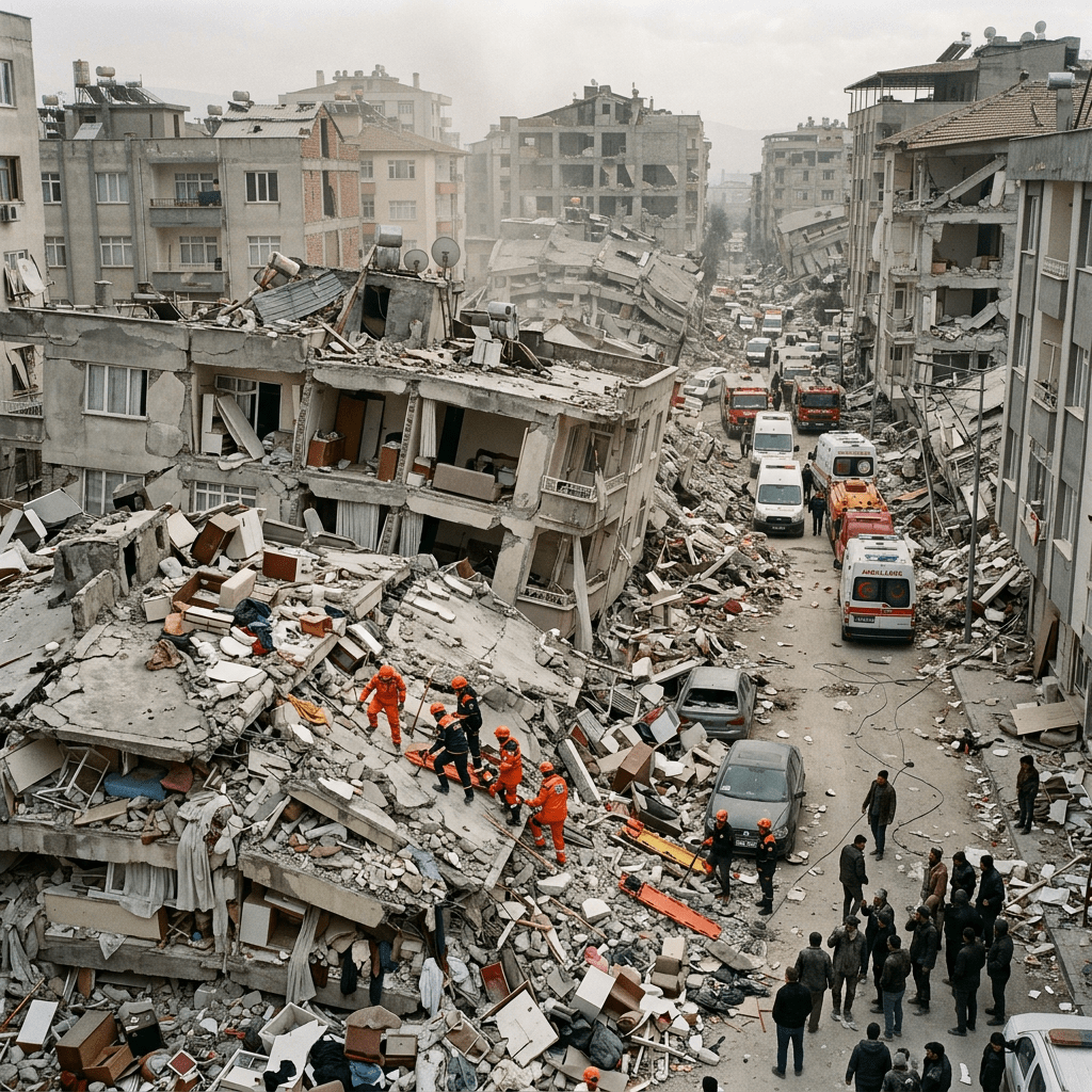
Globally, there are approximately 20,000 earthquakes located every year by the National Earthquake Information Center. This averages out to about 55 earthquakes per day.
The vast majority of these are too small to be felt by humans and do not cause damage.
For larger and more major earthquakes (magnitude 7.0 or greater), there are historically about 16 per year on average.
In an earthquake, the single most important principle is protecting yourself immediately.
Here’s a clear, practical guide you can rely on. It is structured for what to do during, after, and before an earthquake so you’re genuinely prepared.
Immediate actions during an earthquake
The safest response is: Drop, Cover, Hold On. Drop. Get down on your hands and knees so the shaking can’t knock you over.
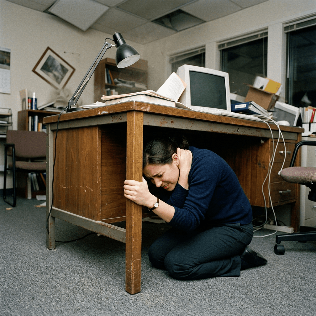
Cover, Take shelter under a sturdy table or desk. Protect your head and neck with your arms if no shelter is available.
Hold On, stay under your shelter and hold on until the shaking stops.
If you’re indoors
Stay inside; do not run outside. Most injuries happen from falling debris near exits. Move away from windows, mirrors, glass doors, and tall furniture that can topple.
Stay in a structurally strong spot: under a table, next to an interior wall, or in a hallway. If you’re outdoors
Move to an open area away from buildings, trees, streetlights, and power lines. Stay low and protect your head.
If you’re in a vehicle
Pull over safely and stop. Avoid bridges, tunnels, overpasses, and buildings that could collapse. Stay inside the vehicle until the shaking stops.
After the shaking stops
Check yourself and others for injuries; provide first aid if needed.
Expect aftershocks for they can be strong. Stay alert and ready to Drop, Cover, hold on again.
Avoid damaged buildings; structural weaknesses may not be visible.
Turn off utilities only if you smell gas, see sparks, or notice electrical damage. Use text messages instead of calls to avoid network congestion. Listen to local authorities for instructions, especially regarding evacuation or shelter.

Preparation before an earthquake
Secure heavy furniture, appliances, and shelves to walls. Store emergency supplies: water, food, flashlight, radio, first-aid kit, medications.
Know safe spots in each room and practice the Drop. Cover. Hold On routine.
Keep shoes near your bed as broken glass is common after earthquakes. Plan a family communication and meeting strategy.
A quick takeaway
Earthquake safety is about immediate protection, avoiding falling hazards, and staying calm until the shaking stops. Preparation beforehand dramatically reduces risk. Let readers know what you think

THANK YOU FOR SHARING WITH FRIENDS AND SOCIAL MEDIA
Share this:

Categories: Family & Parenting



Thanks Mike for always en lighting us with your articles, regarding the earthquakes a 10.0 is coming in Northwest of USA that will shake to eastern Canada indeed. People in California is due for 8.5 plus as well. No one is ready indeed. We need to get psychology of preparations and also for major disruption , from Ireland to Europa and NAU no one is ready?
LikeLiked by 1 person
We had one here in 1987. I was sitting on the garage floor building a skateboard and thought a large truck had passed.
The earth starts to rumble as Japan has a strong 7.1 earthquake.
Some of those old skate decks are now worth coin in mint condition which is over the first time you go out and use it.
LikeLike
“It Could Be Tomorrow”: California’s Top Earthquake Expert Sounds Alarm On “The Big One”
by Tyler Durden
Tuesday, Aug 04, 2026 – 05:40 PM
A new peer-reviewed study found that the fault system running beneath Los Angeles and the Inland Empire is carrying more stress today than at any point in the last millennium, and that a single rupture could tear across both the San Andreas and San Jacinto faults at once.
The research, led by Dr. Liliane Burkhard of the University of Bern and published in the Journal of Geophysical Research: Solid Earth, simulated 1,000 years of earthquake cycles on the southern San Andreas and San Jacinto systems.
The flashpoint is Cajon Pass, the junction northeast of Los Angeles where the two systems meet, and where Interstate 15, freight rail lines, power corridors and the aqueducts that supply Southern California’s water all cross.
The model puts Coulomb stress at 3.6 megapascals on the San Jacinto-Bernardino segment, the highest value anywhere in the entire 1,000-year reconstruction, and 2.8 megapascals on the San Andreas Mojave South segment. Both are elevated, and both are closely aligned, the same configuration that preceded joint ruptures in the past.
Researchers caution these are modeled values that depend on the simulation’s assumptions, not direct measurements from underground. Burkhard’s team describes Cajon Pass as an “earthquake gate,” a junction that can either stop a rupture cold or let it through.
LikeLiked by 1 person
Global quakes are important as Global shortage of oil and gas indeed? picture of week . God Bless you all till soon..
LikeLike
9-26-26 is something will happen? what is it ?
WASHINGTON SKY TURNS DEEP RED ALONG THE COAST Something strange has been happening over coastal Washington. Last night, the sky took on an intense red appearance, but witnesses say this wasn’t the first time. People in the area say the unusual color has been appearing repeatedly for nearly two weeks, with no known wildfires in the immediate area to explain it. Night after night, the red keeps returning. 👇 Anyone along the Washington coast seeing this? #MrMBB333 #Washington not yet 9-26-26 when the china quake hit sky was pink?
https://x.com/asiathemystic/status/2102039830624686412/photo/1
We first report it 48 hours ago … Why when you talk to relatives in CAL people are on nerves always? ask them nicely?
LikeLiked by 1 person
We told you last few weeks that there will come 5 Hurricane to California now this one called POLO is Category 5 right now?
Will It Hit California? Hurricane Polo Nearly Set A World Record As It Rapidly Intensified Into An “Extremely Dangerous” Category 5 Storm? North Carolina, West Virginia?
Hurricane Polo is an absolutely monstrous storm that everyone that lives in the entire state of California should be closely monitoring right now. On Monday, it was just a tropical storm that very few people had heard about. By Tuesday, it had become the most intense hurricane in the Western Hemisphere so far this year. It experienced one of the fastest rates of rapid intensification on record, and it is now a Category 5 storm. The National Hurricane Center is calling Polo “extremely dangerous”, and meteorologists are waiting to see what it does next. Is it possible that it will actually hit California?
It is very rare to see a storm of this magnitude in the eastern Pacific.
According to CNN, Hurricane Polo “is still strengthening” even after reaching Category 5…
165 mile per hour winds can literally rip homes to shreds.
So this is a very, very serious storm.
The National Hurricane Center is usually very conservative in describing storms, but even they are calling it “extremely dangerous”, and they expect Polo to continue to intensify through Wednesday…
For now, Hurricane Polo is expected to move parallel to Mexico’s coastline.
But after that, where it will go is not exactly clear…
There are some models that have Hurricane Polo tracking way out into the Pacific.
But there are other models that have Hurricane Polo moving “toward California, Arizona, New Mexico and Texas”…
No hurricane has ever made landfall in the entire recorded history of the state of California.
If Hurricane Polo were to do so, it would truly be a historic event.
So we shall watch and see what happens.
On Monday, nobody was even talking about Polo.
But then it transformed from a weak tropical storm to a Category 5 monster in a 24 hour period…
Conditions have to be just right for extreme rapid intensification to occur.
On Monday, Hurricane Polo benefitted from “low wind shear, humid air and deep, warm ocean water”, and that resulted in a level of intensification that was “truly remarkable”…
As it went through the process of rapid intensification, Hurricane Polo almost set a world record.
In fact, it came within 10 mph of matching the rapid intensification that Hurricane Patricia experienced in 2015…
To me, it is very interesting that Hurricane Polo went through this process of extreme rapid intensification as millions of people around the world observed Yom Kippur.
Also on Monday, California Governor Gavin Newsom suddenly declared a state of emergency…
Did Newsom just figure out that this Super El Niño could be a problem?
Of course not.
So why was there such urgency to declare a state of emergency?
There is no imminent threat to the state from this Super El Niño other than Hurricane Polo.
But we are supposed to believe that this state of emergency doesn’t have anything to do with this storm.
Maybe that is true, but I am not buying it.
I think that Newsom and his minions realize that Hurricane Polo could potentially slam into their state.
If it does, the damage will be off the charts.
Of more immediate concern is the “massive nor’easter storm” that has started to pummel the east coast…
I could have easily done an entire article about this storm, because it is going to hit tens of millions of Americans really hard.
According to AccuWeather, extremely damaging coastal flooding is expected all the way through Friday…
LikeLike
CAN SI NEW NAME FIR AI STARTS WORLD WAR 3?
BALOOCHESTAN IN IRAN ARE IN STATE OF RIOTS… GLOBAL NEWS SOURCE ONLY ..
IRANIAN SKIES ARE CLOSED FOR FINAL BATTLE. STILL CHINESE PR XI JING IN USA AS SOON AS HE LEAVES USA THINGS WILL NOT BECOME THE SAME?
ALL PLANES FOR FUEL THROUGH AIR ARRIVED IN ISRAEL.. ISRAEL SOONER THAN LATER WILL HIT IRAN FOR LAST TIME.. I ASK MOJTABA GAY LEAVE IRAN TO RUSSIA AND SURRENDER ALL FORCES TO THE PEOPLE DEMOCRATIC OF IRAN..
LikeLike
This Is What A “Perfect Storm” Looks Like: A Global Fertilizer Crisis, A Global Fuel Crisis, A Super El Niño And World War 3 All At The Same Time and picture of week ?
Leave your comments and let global readers what you think?
LikeLike
What happens when two massive hurricanes collide? It looks like we are about to find out. Hurricane Polo and Hurricane Odalys are heading directly toward one another. Meteorologists have some theories about what will happen as they slam into one another, but nobody really knows. Meanwhile, Tropical Storm Nolo is poised to become Hurricane Nolo. We are being told that it could drop several feet of rain on some parts of Hawaii. Of course the east coast is not being left out of the chaos either. An absolutely huge nor’easter is already causing severe flooding on the east coast. We were anticipating that we would see some absolutely crazy weather this fall, and that is exactly what we are getting.
Hurricane Polo has been absolutely shocking the experts for days.
It went from being a weak tropical storm to a Category 5 hurricane in just 24 hours.
On Thursday, it dropped down to a Category 4 storm, but we were being told that some “near-term strengthening is possible”…
That forecast turned out to be accurate, because now it appears that Hurricane Polo is about to strengthen into a Category 5 storm for a third time…
https://endoftheamericandream.com/hurricane-polo-and-hurricane-odalys-are-on-a-collision-course-nolo-could-dump-several-feet-of-rain-on-hawaii-and-a-giant-noreaster-is-flooding-the-east-coast/snip20260924_6/#main
There is nothing about Hurricane Polo that is normal.
The rate at which it originally intensified into a very powerful hurricane stunned everyone, and it ultimately became the second most powerful storm ever recorded in the Eastern Pacific…
In addition, a temperature reading that was actually taken inside the eye of Hurricane Polo matched an all-time record that was established by Hurricane Rita all the way back in 2005…
Everything about this storm seems designed to get our attention.
And now Hurricane Polo is on a collision course with another hurricane.
Hurricane Polo is currently headed in a northwesterly direction and that will take it right into the path of Hurricane Odalys…
Many meteorologists think that Odalys will fizzle out as it encounters Polo.
But Philippe Papin, a senior hurricane specialist at the National Hurricane Center, is warning that there is a possibility that Hurricane Odalys could actually “pull Polo further to the north”…
That is a major bombshell.
Right now, we are being assured that Hurricane Polo will make landfall somewhere along the Baja peninsula…
http://endoftheamericandream.com/wp-content/uploads/2026/09/Snip20260924_5-950×778.png
But if Hurricane Polo gets pulled “further to the north”, it could bypass the Baja peninsula altogether.
In such a scenario, there is a possibility that it could actually make landfall in California.
Needless to say, that would be a truly monumental event.
At the same time, Tropical Storm Nolo is getting stronger as it heads toward Hawaii…
This is also a very serious storm.
At this stage, even Accuweather is warning that Nolo could potentially do even more damage than Hurricane Lala did…
Friday and Saturday are expected to be the critical days for this storm.
Maui is expected to get about 20 inches of rain and the Big Island is expected to get up to 35 inches of rain in some areas.
But if a worst case scenario materializes, Accuweather says that up to 55 inches of rain is possible…
I can’t even imagine what that much rain would look like.
On the east coast, a very scary nor’easter is going to create all sorts of chaos in the days ahead.
It is technically not a hurricane, but in many ways it is acting like one.
In fact, we are being told that models are projecting that it will develop “a giant eye at its center by Saturday”…
This storm is going to cause so much flooding.
In fact, severe coastal flooding has already started in Virginia…
We haven’t seen a storm of this magnitude on the east coast in quite a while.
Meteorologists are expecting that New England will get hit the hardest…
If you live on the east coast, please take this storm very seriously.
If you live in Hawaii, please stay inside this weekend.
And if you live in California, I would suggest watching the path of Hurricane Polo very closely.
The weather has become very “interesting” during the second half of 2026, and I am convinced that a lot more surprises are still ahead.
9-26-26 full Moon so i predict till OCT 11 26 RING OF FIRE WILL SHAKING 6 PLUS QUAKES… and rest of it you know … MN
LikeLike
LARGE EARTHQUAKE ROCKS S. PACIFIC What started out as a M7.0 was just changed to a M6.6 earthquake with a very shallow depth of only 6.2 miles. Vanuatu is home to some big quakes in the past but they are usually very deep. This being strong and shallow in the ocean may trigger a tsunami of some sort. It’s still early as it just recently occurred and data is still coming in. More updates the situation changes. If you read my predictions i said till OCT 1126? Full Moon 9-26-26 will bring a lot disasters?
some saying both went down at roughly the same time. Right now, there’s no confirmed explanation for what caused the disruption or how widespread it may be. If this happened to you, tell us your STATE, CELL CARRIER and INTERNET PROVIDER below. Let’s see how far this reaches.
Krista said God please shut down internet for good?
LikeLike
Powerful nor’easter floods Northeast, knocks out power and disrupts hundreds of flights 4300 OF THEM?
A powerful September nor’easter has flooded parts of the Northeast, knocked out power, and disrupted hundreds of flights as coastal towns take the full force of wind-driven water and pounding surf.
The storm intensified as it moved up the coast, with the worst conditions expected from Friday evening through Saturday and Sunday night in southeastern New England. AccuWeather meteorologists said the event may be remembered primarily for devastating coastal flooding and severe beach erosion, especially along eastern Long Island and the Massachusetts coast, where strong winds have driven water ashore and threatened coastal property.
It is not only a flood story. Wind gusts could reach 60 to 80 mph in parts of southeastern New England. With trees still in full leaf and soil already soaked, those gusts can topple trunks and bring down lines in regional outages. Heavy rain adds another layer of danger: parts of Massachusetts could see 4 to 8 inches, with local totals as high as 13 inches.
The storm is unfolding through a full moon, which raises tide levels and worsens inundation. Long-duration surf is expected to chew beaches from North Carolina to southern Maine. Rain, strong coastal winds and flood risk were forecast to linger into Sunday across portions of the Northeast.
Communities along the Mid-Atlantic and New England shores have been told to treat the combination of high water, gale-force gusts and washed-out roads as a multi-day siege—not a single high-tide scare. The meter is still running on how much sand, pavement and power the storm takes with it before it finally pulls away.
LikeLike